Distance Learning, mLearning, Digital Education, Technology
12.1K views | +2 today
Follow
Distance Learning, mLearning, Digital Education, Technology
Your new post is loading...
Rescooped by Dennis Swender from iGeneration - 21st Century Education (Pedagogy & Digital Innovation)
Scoop.it!

TheTechSpec Blog: Using Google Maps with Siri

TheTechSpec Blog:  Using Google Maps with Siri | Distance Learning, mLearning, Digital Education, Technology | Scoop.it
Educational Technology, tech tutorials, tech tips, Google Apps, Google in Education, Tech on the Side
Via Tom D'Amico (@TDOttawa)
No comment yet.
Rescooped by Dennis Swender from iGeneration - 21st Century Education (Pedagogy & Digital Innovation)
Scoop.it!

10 Lesser-Known Features in Google Maps via Andy Betts

10 Lesser-Known Features in Google Maps via Andy Betts | Distance Learning, mLearning, Digital Education, Technology | Scoop.it
ANDROID
10 Lesser-Known Features in Google Maps for Android

Andy Betts

Via Tom D'Amico (@TDOttawa)
No comment yet.
Rescooped by Dennis Swender from TEFL & Ed Tech
Scoop.it!

How to make awesome interactive map using Google Sheets in under 1 minute? - Geoawesomeness

How to make awesome interactive map using Google Sheets in under 1 minute? - Geoawesomeness | Distance Learning, mLearning, Digital Education, Technology | Scoop.it
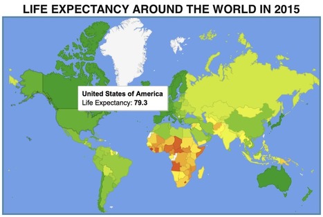
Tweet Share on Facebook Share Share Email Pin Pocket Flipboard From time to time you need to very quickly make a choropleth map based on a spreadsheet. There are a lot of different ways to do it but most of them require registering in one of the mapping services, having Excel plugin or a GIS software installed. …

Via Suvi Salo, Evdokia Roka
No comment yet.
Rescooped by Dennis Swender from Visual Design and Presentation in Education
Scoop.it!

13 Great Tools for Creating Your Own Maps to Use in Class via @Medkh9

13 Great Tools for Creating Your Own Maps to Use in Class via @Medkh9 | Distance Learning, mLearning, Digital Education, Technology | Scoop.it

Via Tom D'Amico (@TDOttawa) , Peter Mellow
RESENTICE's curator insight, February 14, 2016 3:00 AM

Des exemples d'outils de création de cartes à utiliser en classe et à partager... 

Rescooped by Dennis Swender from iGeneration - 21st Century Education (Pedagogy & Digital Innovation)
Scoop.it!

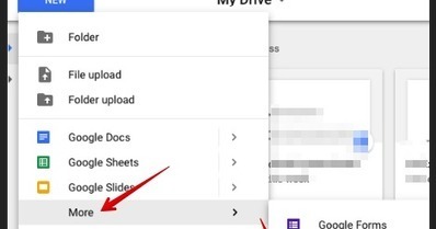
Here Is How to Create Your Own Maps Using Google Drive via educators' technology

Here Is How to Create Your Own Maps Using Google Drive via educators' technology | Distance Learning, mLearning, Digital Education, Technology | Scoop.it
Free resource of educational web tools, 21st century skills, tips and tutorials on how teachers and students integrate technology into education

Via Tom D'Amico (@TDOttawa)
No comment yet.
Rescooped by Dennis Swender from iPads, MakerEd and More in Education
Scoop.it!

An Interesting App for Adding Maps to Photos - Educators Technology

An Interesting App for Adding Maps to Photos - Educators Technology | Distance Learning, mLearning, Digital Education, Technology | Scoop.it
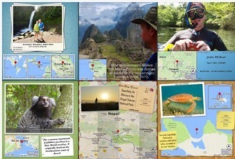
Photo Mapo is a cool iPad app that allows you to add maps to your photos.You can use it to add context to photos you include in your instruction and create mapped collections that can be easily shared with others. Photo Mapo, as we have indicated in an earlier post, is on sale now for free and only for a limited period of time. This deal is valid at least in the Canadian and American iTunes App Stores. Hopefully it will be still free by the time you are reading this post.

Via John Evans
No comment yet.
Rescooped by Dennis Swender from E-learning
Scoop.it!

10 Ways to Use Google Maps in the Classroom

10 Ways to Use Google Maps in the Classroom | Distance Learning, mLearning, Digital Education, Technology | Scoop.it
By Jessica Sanders Google Maps is a great free tool for teachers to engage students. They’ll love mapping major novel moments, guessing locations based on clues, and investigating cities around the world.

Via paul rayner
No comment yet.